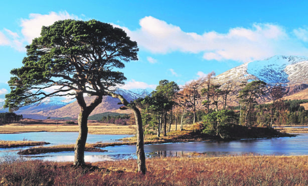
At 1,108m (3,635ft) Meall a’ Bhuiridh is the highest summit in a fine set of hills known as the Blackmount.
There are four Munros in the Blackmount and they neatly divide into sets of two – the northern pairing of Meall a’ Bhuiridh and Creise, and in the south Stob Ghabhar and Stob a’ Choire Odhair.
Both are good days out, but linking all four gives one of the best hill days around – the Blackmount Traverse, a Scottish mountaineering classic. It’s a testing day, that only fitter walkers should take on.
Linking the two sets of hills could be tricky in poor weather, but what an outing! One of the reasons I recommend it is because, for me, all the skiing infrastructure on Meall a’ Bhuiridh kind of spoils that hill as a single, or even, with Creise, as a double Munro outing.
The full traverse is so spectacular, it makes up for that. I accept the ski centre brings employment, provides an enormous tourism boost to the local economy and is a fantastic leisure resource – but the lifts, buildings and bulldozed tracks it requires detract, I feel, from the hill as a walking area, especially in summer when the lack of snow ensures the infrastructure is exposed.
And in winter, it’s easy, as a walker, to feel a bit in the way of all those enjoying the snow sports. For experienced scramblers who want to avoid the skiing infrastructure, Creise and Meall a’ Bhuiridh can be climbed as a pair via Sron na Creise – a tough Grade 2/3 scramble. It’s very exposed and loose and not for beginners.
Reaching the start involves a long, pathless walk from the ski centre over tussocky, heathery ground, or by fording the River Etive – not always possible.
One of the highlights of the traverse is the chance to experience Scotland’s “other” Aonach Eagach. It’s the name given to a short, rocky and occasionally narrow section of ridge on the Munro Stob Ghabhar. It’s a very simple, short and fun scrambly section – nowhere near as difficult as its better-known big cousin in Glen Coe.
Pronunciation: Me-yal a Vooray;
Meaning: rounded hill of the bellowing (of rutting stags)
Height: 1,108m (3,635ft); Rank: 45
OS Landranger Maps 41 & 50
Summit grid ref: NN25150
Nearest town: Glencoe, 20km (12.4 miles) north-west. Although a small village, it has great facilities. Accommodation options include hotels, B&Bs, campsites and a youth hostel.
Start grid ref: NN270418
Distance: 21km (13.1 miles)
Ascent: 2,100m (6890ft) Time: 10hrs
Leave a vehicle at Glencoe Mountain Resort, then drive to car park near Inveroran Hotel.
From there, cross bridge, follow track west along river until Glasgow Uni Club hut. Head north on boggy path. It crosses small river then zig-zags to summit of Stob a’ Choire Odhair. West lies the bealach with Stob Ghabhar. Continue west, heading up to crest of Aonach Eagach. The ridge joins the south-east ridge. Climb this to summit. From here, north-west then north takes you on to Aonach Mor ridge. A spur a couple of km along juts north-east. It leads to bealach with Clach Leathad. Then a steep climb to east ridge of Clach Leathad – Munro top of Creise. Backtrack to col at 1,070m (3,510ft), then east down loose terrain to bealach with Meall a’ Bhuiridh. It’s a steep pull up to summit of the day’s fourth Munro. The descent is just east of north. The final 1km (0.6 miles) or so follows steep ground beneath, back to centre car park.

Enjoy the convenience of having The Sunday Post delivered as a digital ePaper straight to your smartphone, tablet or computer.
Subscribe for only £5.49 a month and enjoy all the benefits of the printed paper as a digital replica.
Subscribe