New landscape data will have a “significant impact” on biodiversity, carbon accounting and environmental projects across Britain, the national mapping service has said.
Ordnance Survey, which is known for paper maps but has undergone a digital transformation in recent years, made the biggest update to its National Geographic Database this week since 2020.
The database contains millions of pieces of information on Britain’s landscape – including names, places and objects – as a service to governments, businesses and individuals.
As part of the update, Ordnance Survey launched new “Field Boundary” data, which details the type of boundaries surrounding different land areas – like man-made walls, trees or hedgerows – as well as their height and width.
The mapping service has also added to its “Land Cover” data, which documents different categories of natural land surface, such as trees, water and grassland, across the UK.
Both areas of data can be used by landowners, farmers and organisations to monitor changes to Britain’s landscape over time, it said.
The changes mean they will now be able to better measure biodiversity net gain or losses as well as provide evidence for carbon offsetting and environmental land management schemes (Elms), which are nature-friendly agriculture subsidies.
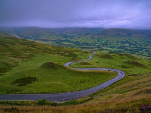
For example, the Peak District National Park said it will compare the Field Boundary data with old Ordnance Survey maps that have been digitalised.
The organisation can then analyse how the park’s landscape has changed since the 1950s due to impacts like climate change, and determine where work is needed to protect nature.

The mapping agency has aligned its Cover Land data with two existing habitat classification schemes – the European Nature Information Systems (EUNIS) and the UK Biodiversity Action Plan (UK BAP).
Both are used to assess both positive and negative impacts of human activity on biodiversity and ecosystems.
Ordnance Survey also added percentages to its Land Cover data, which were calculated with the help of machine learning, to act as a “consistent baseline” for monitoring land over time.
For example, it currently shows that 45.3% of the Peak District National Park is made up of “Bare Earth or Grass” and 3.8% is made up of non-coniferous trees.
Elsewhere, Ordnance Survey said the Field Boundary data can provide evidence of new or growing hedgerows for a new Elms programme that incentivises farmers and landowners to plant and maintain them.
It added that local authorities can use the information to identify where there are – or are not – wildlife corridors and pollinator networks, to help deliver mandated nature recovery strategies.
For developers in England, the information provides a tool to meet the new requirement of restoring any nature plus an extra 10% that is lost when building new housing, the agency said.
More widely, it will support the development of future environmental policies and targets, Ordnance Survey said.
Jessica Gaskell, its lead for Public Sector Geospatial Agreement (PSGA) Investment, said: “Sustainability and net zero goals are more important than ever before, and these data enhancements will support organisations meet their commitments by providing them with greater insights into Britain’s natural environment.
“Having a deeper understanding of the locations of hedgerows and the land cover surface across our natural environment will have a significant impact on a variety of biodiversity activity and we are delighted that OS can play a role in supporting this.”
David Alexander, the Peak District National Park’s senior research and data analyst, said: “If we understand the condition of the national park’s landscape, we can protect and preserve those valuable landscape features – a process that can be replicated by other national parks.
“The new Field Boundary data is fantastic. The OS National Geographic Database (NGD) makes it accessible, easy to work with, and the data just keeps getting better and better – with so many applications for it.”
The new data will be accessible through the Ordnance Survey data hub for private customers and public sector organisations.

Enjoy the convenience of having The Sunday Post delivered as a digital ePaper straight to your smartphone, tablet or computer.
Subscribe for only £5.49 a month and enjoy all the benefits of the printed paper as a digital replica.
Subscribe