Scotland will see no let-up in the wet weather which has saturated the country as more rain is set to arrive.
The Met Office has issued a yellow warning for rain tomorrow afternoon and evening for south-west Scotland moving into the central belt, with ice in parts in the morning.
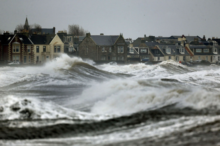
Todday, some areas on the east coast were flooded as a tidal surge saw waters rise.
In Musselburgh, East Lothian, the River Esk flooded its banks with locals saying it was the worst they had ever seen.
Louise Macdonald, CEO of the Young Scot charity, said on Twitter: “Wow. I’ve never seen the water so high at Musselburgh Harbour in all the years I’ve lived here. Incredible.”
However, despite warnings of floods affecting areas from Fife down to the Borders, there were no reports of any major incidents.
While the worst is over for now, the authorities have warned that unsettled weather is set to continue.
SEPA the Scottish Environment Protection Agency said in a statement: “River and loch levels remain high, but the picture is generally improving with some respite until further rain on Sunday afternoon.
“There is no immediate prospect of an end to the unsettled weather, which means the situation will be kept under close observation and further alerts and warnings will be issued as necessary and displayed on the website.”
Met Office forecaster Peter Sloss said another band of wet and windy weather would push in from the south today reaching the north-east by this evening.
He said: “It won’t be as wet or as windy as it has been.
“Because the rain is falling on saturated ground, there could be some local issues, but nothing particularly heavy other than tonight.
“From Monday to Wednesday is more of a southerly airflow. Everybody will catch showers, but nothing lasting for a long period of time.
“There are more high tides expected on Monday and strong to gale-force winds, so there could be some impacts from that. But we are not going to see anything extreme over the next week or so.”
The Scottish Government Resilience Room met for the 12th time since Christmas Eve yesterday to co-ordinate the ongoing response to weather incidents.
Environment Minister Paul Wheelhouse, who chaired the meeting, said: “Scotland’s agencies are continuing to work hard to provide a co-ordinated response to these difficult conditions and I’d like to pay tribute to the dedicated efforts of everyone involved.
“After the excellent efforts of the responders on the west coast, now services across the east are ready to react swiftly to minimise the impact of flooding.”
Transport Minister Keith Brown said: “The advice, as always, is to prepare in advance for any travel. People should drive to the conditions, adhere to police advice and allow extra time for any journeys they are planning to make.”
On Friday, the west of Scotland was battered as tidal surges and heavy rain hit coastal areas.
SEPA says that in December, Scotland had 180% of its average long-term rainfall.

Enjoy the convenience of having The Sunday Post delivered as a digital ePaper straight to your smartphone, tablet or computer.
Subscribe for only £5.49 a month and enjoy all the benefits of the printed paper as a digital replica.
Subscribe