There is a point while cycling uphill on a steep, narrow road in Perth and Kinross when I’m unsure if I can continue to push my pedals around.
My leg muscles are throbbing painfully and, without looking down, I know I’ve no more gears to slip into. The only option is to rise from my saddle, grit my teeth and attempt one more revolution – and then another.
Of course, I could stop, get off my bike and push it to the highest point on the road in Glen Quaich. But that still appears a long way ahead.
From the corners of my eyes, I glimpse heather-clad hillsides undulating into the distance. The calm water of a loch sparkles in the sunshine and three red kites soar confidently in a bright blue sky.
It is these rewards that provide a useful distraction to the continuing agony in my thighs and calves. Then, finally, comes the best prize of all – after miles of ascending, there is the fabulous descent.
Suddenly, I am freewheeling downhill from a high of just over 518 metres (1,700ft) and on a beautifully winding stretch of road. The picturesque landscape whizzes by, now a blur of summer hues of purple, ochre and green.
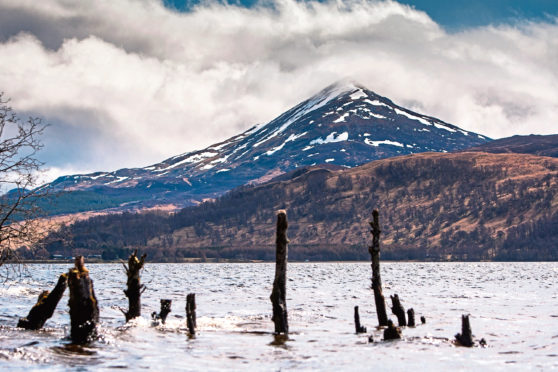
I see the pointed outline of the iconic mountain, Schiehallion, to the north, while the huge expanse of Loch Tay, to the west, grows ever bigger. Having set off from the more southerly settlement of Comrie earlier in the day, the long downhill towards the loch-side village of Kenmore is a welcome rest for tired legs.
So far this morning, I’ve cycled about 40 miles through the town of Crieff, then on to a single-track road uphill via peaceful Sma Glen to reach the hamlet of Amulree, before riding Glen Quaich.
Yet, there are still many miles to cycle today as I aim to complete a 100-mile route of the Ring of Breadalbane. The brainchild of the Breadalbane Tourism Co-operative, a series of rings offer road and trail cyclists, as well as walkers, different routes to follow.
The rings were inspired by Breadalbane’s Tolkienesque scenery. The landscape of the area’s mountains and glens is likened to that of Tolkien’s books – and the subsequent films – The Lord Of The Rings.
Next on my challenging circuit is the popular tourist village of Kenmore, which offers the perfect place for much-needed coffee and cake before I head east to the market town of Aberfeldy.
The map directs me north and then west to cycle through Appin of Dull. I hope it doesn’t live up to its literal definition.
The area is a flatland – or strath – of the River Tay to the south of the settlement of Dull and between Aberfeldy and Loch Tay.
I later discover that Appin means abbey land and is associated with the foundation of St Adamnan church, that once flourished here.
Riding past a signpost for Dull makes me giggle, especially when I see it is paired with Boring in Oregon, US. The name Dull is thought to be Pictish, derived from the word dol meaning water-meadow or haugh.
I leave the B846 after Dull, for a quiet road signed to Fortingall, at the foot of Glen Lyon. Fortingall is famous for thatched cottages, Europe’s oldest living tree and is said to be the birthplace of Pontious Pilate.
Again I feel the build of an ascent, at first gradual and then more demanding, as I cycle Glen Lyon – Scotland’s longest glen. Golden eagles are often seen here but I am not lucky with this bird of prey. It matters not because the scenery is fabulous, with a river flowing along the glen and forests, hills and mountains in every direction.
I am grateful for another food stop at Bridge of Balgie, at the head of Glen Lyon, before the next climb. My legs complain intensely as I cycle south, up and up again, to reach the highest point on the ring at 565 metres (1,855ft).
It’s a tough ride and as I make it to the top of the road I notice I’ve ridden almost 70 miles. I enjoy more spirit-lifting views, including the lofty summits of the Lawers mountain range, before a sublime descent towards the northern shore of Loch Tay.
The road passes the National Trust for Scotland’s Ben Lawers National Nature Reserve car park. Turning right at the end of the descent, I cycle a section of the busier A827 to reach Killin – home to the breathtaking Falls of Dochart – at the loch’s western end.
I had been hoping the rest of the route would be downhill or flat, but there are still plenty of climbs and bumps to negotiate. However, I’m grateful for the warm and dry weather as I ride uphill again in Glen Ogle.
Reaching the highest point at 183 metres (600ft), I take another breather. My legs are fatigued and I need to stretch out tired upper body muscles and sore hands that have taken the brunt of the handlebar pull on the uphills and the braking on the downhills.
I’m rewarded for the stop with a beautiful northern vista of the ridge of Meall nan Tarmachan. A southern aspect reveals more hills and mountains, including Ben Vorlich.
The next descent to Lochearnhead is over too quickly, although I welcome a more gradual downhill as I ride along the southern shore of Loch Earn, this time travelling east amid pretty birch woods.
Just after Lochearnhead, the road passes above restored Edinample Castle. From a bridge, it’s possible to clamber down to view the Falls of Edinample
At the eastern end of the loch is St Fillans. There is an impressive rock, atop which is the remains of Dundurn Hill Fort. This is thought to be a Pictish royal fort.
And then, finally, I ride on to the A85, before a detour on to a quieter B road that follows the route of the River Earn back to the start point at Comrie.
My GPS watch says 102 miles, which takes into account a few short detours, and a total ascent of almost 2,286 metres (7,500ft).

Enjoy the convenience of having The Sunday Post delivered as a digital ePaper straight to your smartphone, tablet or computer.
Subscribe for only £5.49 a month and enjoy all the benefits of the printed paper as a digital replica.
Subscribe