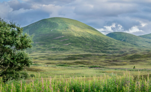
Part of a tight cluster of four Munros just west of the Drumochter Pass, A’ Mharconaich will be a familiar site to anyone travelling on the A9.
A’ Mharconaich is the most distinct of these mountains, its shapely, rolling outline well seen from the roadside. The Drumochter Munros have a bit of a bad rep among some hillwalkers. They’re often dismissed as “boggy, shapeless lumps”, worthy of climbing only because of their Munro status.
Sure, they’re not dramatic. They don’t have towering, rocky peaks, and their ascents aren’t as exciting as those of certain other hills, but they have their good points. Their proximity to the roadside gives easy access; the height of your likely start point means much of the hard work is already done; it’s a tight-knit group, meaning you can get all four summits in a single trip. Pick the right day and this is a pleasant, high-level moorland yomp with superb views into the Ben Alder range.
A’ Mharconaich is a special hill for me as it was my 141st Munro – the halfway point. I walked the route with my friend Ron Dorn and what made the day even more memorable was that the hill was his 100th Munro – a double celebration!
We walked them in early April, while winter snows still lay and the frozen ground made easy walking of the boggy lower slopes. In very changeable weather, we walked all four Munros, sometimes enjoying superb views, while at other times howling wind and snow showers reduced visibility to almost zero.
En route to A’ Mharconaich, in one of those sudden squally, nasty showers, we met a walker stumbling out of the mist just at the cairn of the lower summit of Beinn Udlamain. We shouted a few words, he took our picture, and then the mist swallowed him once more. We never saw another soul all day.
Guide
Pronunciation: A-var-con-ich
Meaning: The horse place
Height: 975m (3,199ft)
Rank: 179
OS Landranger: Map 42
Summit grid ref: NN604763 (cairn)
Nearest town: Dalwhinnie is a small village 8km (5 miles) to the north. It has a railway station, B&B and bunkhouse accommodation, cafe, bar and, of course, a distillery.
The route
Start grid ref: NN632755
Distance: 25km (15.5 miles)
Ascent: 1,100m (3,609ft)
Time: 7hrs
Start by driving to the car park at Balsporran Cottages (NN628792). Here, you can leave your bike, chaining it to a convenient fence. Then drive south for about 5km (3.1 miles) to layby number 79. Take the old road from the layby, through a gate. After a short distance, fork right on to a track that takes you under the railway.
After fording a small stream, follow the Allt Coire Dhomhain on a good track on its north bank. After about 1.5km (0.9 miles), ford the river (if safe) and head south-west on to the long ridge that takes you to the summit of Sgairneach Mhor. From here, make for the col at the head of Coire Dhomhain, then almost directly north for a little over 1.5km (0.9 miles) to the summit of Beinn Udlamain, the highest of the four Munros at 1,010m (3,314ft).
Take in this hill’s lower summit and continue roughly north-east across the bealach and on to the summit of A’ Mharconaich. You can descend via the long north-east ridge back to Balsporran, or backtrack a few hundred meters before heading north-west to the bealach with Gael Charn, then north for the summit.
The descent can be a bit of a plod in deep, tussocky heather until you pick up another of the bulldozed tracks that take you back to Balsporran, where the waiting bikes are a welcome sight. The cycle path along the A9 makes for a speedy return to your vehicle – although my friend Ron gloomily insists that the quite flat route is entirely uphill!

Enjoy the convenience of having The Sunday Post delivered as a digital ePaper straight to your smartphone, tablet or computer.
Subscribe for only £5.49 a month and enjoy all the benefits of the printed paper as a digital replica.
Subscribe